Talkin Neat Like A Geek
SOmewhERE............................
tumblr

find me on...
Wheel Waits For The Right Moment To Make A Dash For Freedom
#perfectlyTimedPhotos
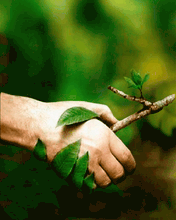
Twin Boys Jumping And Landing At The Exact Same Time
#perfectlyTimedPhotos
It's this cold out here.
An animated map of the changes to the borders of Canada. The borders of Ontario were last changed in 1912.
Animation of the changes to the borders of Canada. The captions read as follows: July 1, 1867: Dominion of Canada formed.
July 15, 1870: Rupert's Land and North-Western Territory join, become North-West Territories; Manitoba formed.
July 20, 1871: British Columbia joins.
July 1, 1873: Prince Edward Island joins.
July 26, 1874: Ontario provisionally expanded north and west. April 12, 1876: District of Keewatin formed.
September 1, 1880: British Arctic Islands joins as part of North-West Territories.
July 1, 1881: Manitoba expanded.
May 7, 1886: Border of District of Keewatin adjusted.
August 12, 1889: Ontario's expansion finalised.
June 13, 1898: Yukon Territory formed, Quebec enlarged.
May 23, 1901: Yukon Territory adjusted.
September 1, 1905: Alberta and Saskatchewan formed, District of Keewatin dissolved.
May 15, 1912: Manitoba, Ontario, and Quebec enlarged; North-West Territories renamed Northwest Territories.
March 11, 1927: Border with Newfoundland adjusted.
March 31, 1949: Newfoundland joins.
April 1, 1999: Nunavut formed.
December 6, 2001: Newfoundland renamed Newfoundland and Labrador.
April 1, 2003: Yukon Territory renamed Yukon ...read more
I love the way ya dance your slow sweet tango.
The way ya wanna do everything but talk.
FOR: facebook
King & Quuen
Funny Memes GIF - Funny Memes - Discover & Share GIFs
Click to view the GIF
tenor